While scientists are trying to explore distant worlds, our planet has not yet been sufficiently explored. The proof is the ocean floor, which is still very unexplored. Only 20 percent of the world’s seabed has been mapped to the appropriate resolution – with grid cells 100 meters or more across, depending on depth.
Seabed mapping
In 2018, a project called the Nippon Foundation-GEBCO Seabed 2030 Project was launched. Its goal is to map 100% of the seabed. The project was created by merging two non-profit organizations – The Nippon Foundation (Japanese philanthropic outfit that has projects focused on the future of the oceans) and GEBCO (group focused on understanding the bathymetry).
“In 2017, only 6 percent of the world’s oceans floor had been adequately mapped,” says Jamie McMichael-Phillips, the project’s director. “Seabed 2030 was designed to accelerate this mapping, using data from academia, government, the maritime industry and citizens themselves.”
The aim of the project is to create a complete map of the seabed that will be publicly available. Seabed mapping is financially and technologically demanding.

Why is it important for the seabed to be mapped?
Many information on climate change can be better understood through information on the shape of the seabed. They can be used to better predict sea level rise and also to predict the path and strength of the tsunami. Mapping is also important for a better understanding of marine ecosystems, which will then be better protected.
“Data is used in coastal ocean science, habitat characterization, wave models, flooding models, wind energy development, all kinds of things,” says Ashley Chappell, integrated ocean and coastal mapping coordinator at the U.S. National Oceanic and Atmospheric Administration (NOAA).

Use of modern technologies
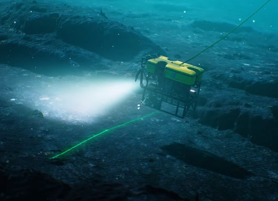
Seabed mapping technology is constantly being improved. In the 1950s, sonar was used to measure depth at a given location. By the 1970s, multibeam sonar was already used, which was installed on various vessels. Modern bathymetry already uses much more modern tools, such as laser imaging technology (LIDAR). Remotely operated vehicles (ROVs) used by scientists at Monterey Bay’s Aquarium Research Institute (MBARI) are best for mapping the ocean floor. This vessel is capable of exploring cold, dark ocean depths. ROV uses lasers, sonar, strobe lights and stereo cameras to create five-centimeter and one-centimeter resolution maps with millimeter-scale photography.
Vessels with sonar must cover 140 million square miles of water and, in addition, must travel slowly.
Still, seafloor mapping is technically difficult and consequently expensive. “An oceanographic research ship with work class deep diving ROV can easily cost $ 35,000 per day and rise to more than double that depending on ship size,” says Caress. “And there’s ship and crew costs on top of that”.
The cooperation of the public and experts is important
It is important that as many people as possible join the project. The cooperation of research organizations, government entities and ordinary citizens is important for the completion of the project. Cargo ships, fishing boats, yachts and other vessels that are equipped with echosounders and set out on various voyages can join. For the project to be successful, data from such ships must also be used.
“There are more than 200 vessels capable of deploying sonar systems,” says McMichael-Phillips, “but the cost of such a feat would be somewhere between $ 3 billion and $ 5 billion, which is not easy to find in the maritime domain.” Crowdsourced data is thus of utmost importance to the project.
Thanks to cooperation with many organizations and the use of new technologies, the vision of mapping the seabed until 2030 seems realistic.
Source & credit:
https://www.smithsonianmag.com/science-nature/can-scientists-map-entire-seafloor-2030-180978004/
Image: Screenshot YT